ATHABASCA — It is a bit of a history lesson in itself, but it is also a movement to preserve that history, even if its actual physical presence has been gone for years.
A group of residents from across the greater Athabasca region have been busy tracking down the physical locations of 85 schools, most of which are long gone, to post signage which may eventually be used for tourism, if the group can get some help in the technical aspects. Representatives recently met with Athabasca County council to discuss the effort.
“I guess for 30 years, I've kept it in mind,” said Larry Armfelt in a May 20 interview. “As I mentioned at county council (May 10), ‘a promise made is a debt unpaid,’ from Robert Service's The Cremation of Sam McGee. In those years though we were still raising kids and school was still in full bore and we were doing other things and it’s 30 years later now.”
Thirty years ago, a few of the same people were working on the history book Out of the Wilderness and the discussion to preserve the school locations was floated at the time, but recently Alice Wlos decided to resurrect the thought.
"She kicked me in the pants and said, ‘Hey, Larry, do you want to get on board?’” Armfelt said. “So, she created that opportunity to start paying my debt.”
Sales of the book, still available at the Athabasca Alberta Treasury Branch, are what is funding part of the project, but it will take a lot more than the $7,000 the group has to get all the signs made and placed.
“The creation of the signs is being done by Fast Signs (in Athabasca) and they're going to be around $300 each (then) installation and everything will be up to us to do it,” he said. “If you look at 80 schools times $300, we’re looking at a total cost of approximately $24,000.”
A few of the signs are being paid for by families who still own the land where one or both parents or grandparents got their educational start, something Armfelt knows personally.
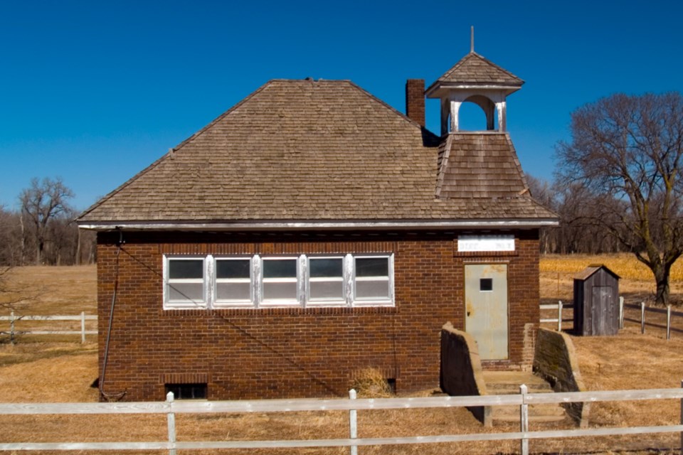
“I started school here at Winding Trail from Grades 1 to 3, but when I went to Grade 4, then we were bussed into Athabasca,” said Armfelt. “And that was just a typical situation all across the province because just slowly, slowly all of those smaller schools got centralized.”
In the early days there was a school, typically a single-room school, built for every 30 sections of land, then as roads improved, costs increased, enrolment declined, et cetera, so they started being amalgamated, but another piece of the puzzle is determining the catchment area because the educational boundaries don’t match the county borders.
“So, if you take all of those areas, and then figure out where the attendance area was, were those kids then in the (then) County of Athabasca or did they go to a school that was under the control of the Athabasca school division?” Armfelt asked. “Those are still a whole pile of unanswered questions that we have to do a fair amount of research on so it's not going to be completed tomorrow.”
And Athabasca County is not without some skin in the game as Smith is not in Athabasca County, but it does fall into the educational boundaries, so back in the day when the county ran the schools there would have been children from Smith going to Athabasca County-run schools.
“We (Armfelt, Wlos, and Darlene Kozinski) went to the county office because we wanted to make sure that when we put these signs up, we're exactly correct and we're not in contradiction to any person that might own the land privately or the county or whatever,” said Armfelt. “We just wanted to make sure we had county support that if we wanted to check out some piece of property just to make sure that we put the sign in the right spot.”
Later on at the May 10 meeting, Coun. Rob Minns asked who would be responsible for signs placed on an Athabasca County right-of-way.
“That’s an inevitable county council question and I respect the question, but for me to forecast the answer to quite a hypothetical question at this time would be impossible,” Armfelt said. "We're certainly not foreign to having suggestions and feedback and input from county. That is the reason that we went to the county council meeting; to make sure they knew what we were doing.”
It was a question from reeve Brian Hall, however, that got Armfelt thinking the group needs someone younger, or at least a bit more tech savvy, involved.
“Brian Hall said, well, can you get this on a QR code or whatever for tourism, or whatever he was alluding to,” said Armfelt. “Well yeah, it would be lovely to do that, but I can't do that. I can't even type with one finger. But certainly, that's where some resources at the county level or the community level would be excellent and then maybe eventually, as a little tourism thing, we could have a map of a road going hither, tither and yon.”
The most important thing though, is to preserve the history, he said.
“The biggest thing is simply to keep these places identified, so that the children and the grandchildren, great grandchildren can say, ‘Hey, that's where my grandfather or grandmother went to school and holy smokes, look at how things have changed,’” he said.

