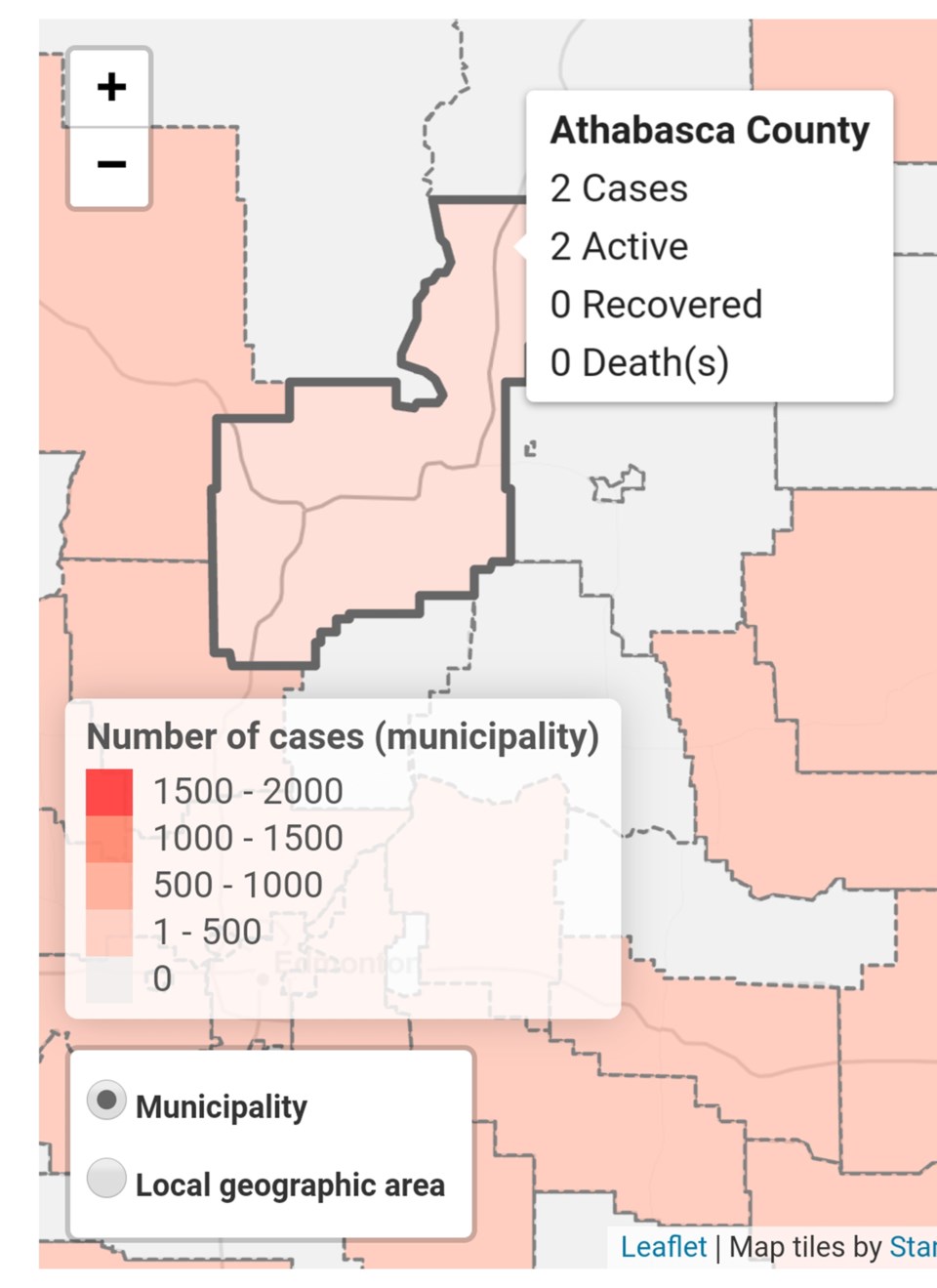
The Athabasca area reported its second positive test for COVID-19 Thursday, the second in as many days.
As of April 23, the Alberta government’s geospatial map now shows a second active case of coronavirus in the area. The map is updated daily, shortly after the afternoon press conference from Alberta's chief medical officer Deena Hinshaw.
There had been no confirmed cases of the virus in the area surrounding Athabasca until April 22.
That day in the province, 306 new cases were reported and 319 more came the next day, bringing Alberta's total to 3,720, which includes 68 deaths.
There are also 1,357 recovered cases documented in the province and nearly 118,000 tests have been conducted.
The geospatial map can be found at https://covid19stats.alberta.ca/ , along with other relevant statistics.
On the map, it shows the County of Barrhead has reported two cases, both of which have recovered. Westlock County shows one active case and one recovered case. The M.D. of Lesser Slave River reports one active case and four recovered cases, while the M.D. of Opportunity remains clear of any cases, as do neighbouring Lac La Biche County, Smoky Lake County and Thorhild County.
Although the precise location of the Athabasca-area patients are currently unknown, the government map, when toggled to geographic area instead of municipality, shows Boyle still without a case.


.jpg;w=120;h=80;mode=crop)
