WESTLOCK/BARRHEAD — Alberta Environment and Parks issued a flood watch for the Pembina River downstream of Entwistle July 2, warning that water levels could reach those experienced in May.
In response, the County of Barrhead and Westlock County are asking residents to avoid activities near the riverbanks.
Barrhead has also closed the low level bridge crossing over the Paddle River on Range Road 40—or the Golf Course Road—north of Township Road 592.
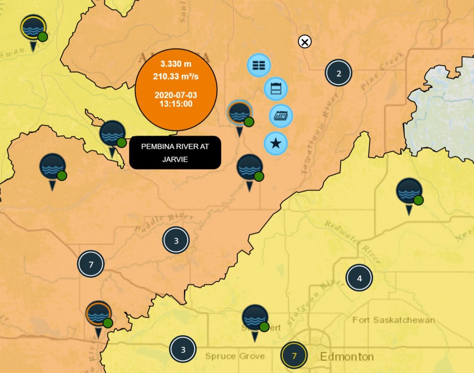
The River Forecast Center with Environment and Parks noted that water levels near Jarvie rose 0.5 metres, but that can go up to 2-2.5 metres July 6.
Further upstream, near Entwistle, water levels are already 2 metres above normal, and may continue to rise.
The Centre also warns that the Pembina River might flood the roadways near Highways 18 and 776, at the border between Westlock County and the County of Barrhead.
Agricultural land that’s near the lower banks of the Pembina could also be affected by rising water levels.


